Experts reveal unusual Arctic weather event that could change Britain's winter forecast
An unusual disturbance high above the North Pole is attracting forecasters’ attention, with the potential to influence Britain’s weather in the weeks ahead. However, it does not guarantee freezing temperatures or snow.
In an update published on 4 November, the Met Office reported signs of a developing sudden stratospheric warming, or SSW. Forecasts suggested that winds above the Arctic could briefly reverse, potentially qualifying as a major event, although this remained uncertain. Its arrival so early in the season would be exceptional.
Why warming above the Arctic can matter.
The name can sound confusing when the possible consequence is colder weather. The warming happens in the stratosphere, roughly 10–50 kilometers above Earth’s surface, rather than in the air we experience outdoors.
During an SSW, temperatures at these heights can climb by around 50°C within a few days. These changes can then alter the jet stream, influencing weather much closer to the ground. This process takes time, and some events have little impact on Britain.
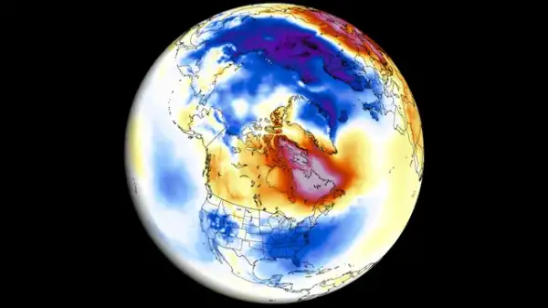 The SSW impacts in the atmosphere (Severeweather)
Central to this process is the stratospheric polar vortex: a circulation of strong winds surrounding cold Arctic air. When it remains strong, it often supports an Atlantic weather pattern that brings Britain relatively mild, wet and windy conditions.
A disturbed vortex can stretch, shift away from the pole, or split. These changes can help disrupt the usual atmospheric circulation, increasing opportunities for colder air to reach parts of Europe.
The connection with El Niño
Conditions in the tropical Pacific can also play a role. El Niño brings unusually warm ocean temperatures that can intensify thunderstorm activity and influence atmospheric circulation.
These changes can strengthen large atmospheric waves traveling upwards towards the stratosphere, where they disturb the polar vortex. This helps explain the link between El Niño winters and a higher likelihood of sudden stratospheric warming.
What could happen in the UK?
If the disturbance influences the lower atmosphere, it may encourage persistent areas of high pressure that interrupt the usual flow of Atlantic weather systems.
Their location matters. High pressure to Britain’s north or northeast can favor colder easterly winds, while other arrangements can allow Arctic air to arrive from the north. Whether this produces snow depends on available temperatures and moisture. Some events bring significant cold spells; others have limited consequences for the UK.
For the developing event, any effects could take two to six weeks to work down through the atmosphere. Its early timing adds uncertainty because the Northern Hemisphere generally has less cold air available than later in winter.
For now, the Arctic disturbance is a reason to monitor changing forecasts, rather than evidence that a severe British winter is on its way.